ELECTRICAL DISTRIBUTION ASSET INSPECTION
GIS inspections yield better asset management results through better data—so you can reduce downtime, improve worker safety, and increase profitability.
Safety, speed, and cost-effectiveness are key to inspecting distribution assets over miles of terrain. Besides the risk and slowness of manual inspections, compiling the data collected into a single, standardized database is a hassle.
PrecisionHawk offers utilities a faster, safer way to inspect and manage distribution assets—so they can keep up with inspection regulations, mitigate risk, and increase customer satisfaction through higher uptime.
Analysts can use high-resolution remote sensing to pinpoint the type and extent of any damage more accurately than a visual inspection can. Integrate our software with your enterprise data management systems to leverage geospatial intelligence across the entire distribution asset life cycle, from selecting sites for future utility poles to decommissioning equipment.
While utility ground teams typically find that 10% of distribution poles are out of compliance, those using PrecisionHawk’s solution have found that the average is actually 30%.
Manage Your Assets Better with Faster, Safer, More Accurate Data
Our industry-leading geospatial technology portfolio, engineered for America’s largest utilities:
DISCOVER 
Define structure shot sheets and data delivery requirements. Determine the information you need to plan your field inspection and CVI projects.


COLLECT 
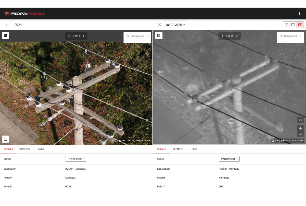
Capture visual imagery using high-resolution aerial cameras. Amplify the volume, detail, and accuracy of your geospatial asset data with visual, thermal, and LiDAR data and record inspection outcomes in a checklist.
PROCESS 
QC data for any required data recollection and upload to servers. Our team of data analysts produces structural models using visual, thermal, or LiDAR data, delivering precise measures of asset height, depth, health, phasing of power cables, lean, and attachments.


ANALYZE 
“Call in” criticals observed in the field and store data for additional analysis. The PrecisionAnalytics AI engine organizes, georectifies, and annotates imagery to address issues specific to your project.
REPORT 
Generate analytics from aggregate inspection outcomes and identify trends. Assess vegetation encroachment, components, and asset health.


ACTION 
Distribute work orders with CVI imagery for context and activate O&M vendors.
- Refine capital budgets using a comprehensive accounting of your assets, including precise geolocation
- Detail work orders, with robust imagery, to repair immediate issues
- Triage repairs by batching work orders depending on the severity of the problem, saving time and money
- Apply for permits and produce planometrics
- Fuel network engineering strategy, modeling out-of-compliance assets in relation to other assets, roadways, and zoning
- Prove regulatory compliance
Distribution Applications
GIS Inventory
Modernizing your grid? Accelerate modernization programs by uncovering incorrect and missing tags, inaccurate pole class and height data, and poles that were not where the utility thought they were—or that were not in their databases at all.


Hardening
Extreme weather events are hitting more often and harder than ever before. Increase the speed and efficiency of pole-hardening programs by getting a holistic, data-rich view of assets with PrecisionAnalytics Energy.
Vegetation Encroachment
PrecisionHawk’s operators collect, process, analyze, and report on LiDAR models to identify vegetation encroachment that can be difficult to spot with the naked eye. View an encroachment map overlaid on a street map, or in a 3D point cloud model, to avoid degradation of assets.


Comprehensive Visual Inspections
Traditional CVIs can be intensive and expensive. By incorporating data collection, processing, and reporting into a streamlined, end-to-end service and software solution, PrecisionHawk has made it easier to use GIS intelligence. Collect more and better data so you can take the right action at the right time.