DISCOVER 
Define project objectives and required measures. Start from a baseline of data analysis deliverables that we’ve optimized to meet FEMA and FERC requirements, or get your own custom data solution.


COLLECT 
Capture visual, thermal, and LiDAR data from the air and ground. Capture precise measurements, geolocation data, and pole health indicators by gathering rich, dense LiDAR point-cloud data—so you can see every knot and crack that may affect pole strength, and which may not be visible in a photograph.
PROCESS 
QA data, georectify imagery and point clouds, and produce models. Our team of data analysts produces structural models using LiDAR data, delivering precise measures of pole height, depth, health, lean, and attachments.


ANALYZE 
Quickly view and validate geolocation, examine asset condition, and direct action. The PrecisionAanlytrics AI engine organizes, georectifies, and annotates imagery to address issues specific to your pole-hardening process.
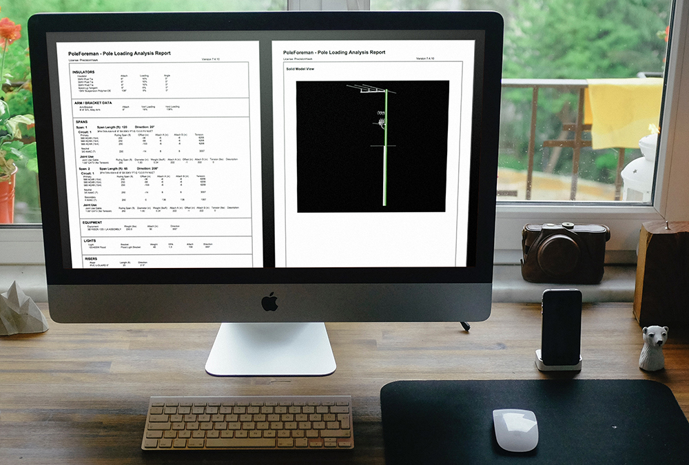
REPORT 
Generate a pole-by-pole report of load and other measures. Enrich your GIS and asset management databases with powerful data from PrecisionAnalytics using the system’s secure API architecture.

ACTION 
Plan upgrades and track progress using PrecisionAnalytics.
- Schedule repairs based on risk, so you can bundle work orders—and not have to mobilize a whole team to work on one pole.
- Refine capital budgets using a comprehensive accounting of your assets, including precise geolocation
- Prioritize improvements based on the criticality of wind/ice load using exact indicators of asset health
- Fuel network engineering strategy, modeling out-of-compliance poles in relation to other poles, roadways, and zoning
- Apply for permits and produce planometrics
- Prove regulatory compliance
- Detail work orders, with robust imagery, to triage immediate issues