DISCOVER 
Define structure shot sheets and data delivery requirements. We’ll help you determine the information you need to plan your electrical asset inspections.
STRATEGIC PARTNERSHIPS
BUSINESS CASE
PROOFS OF CONCEPT
TRAINING


COLLECT 
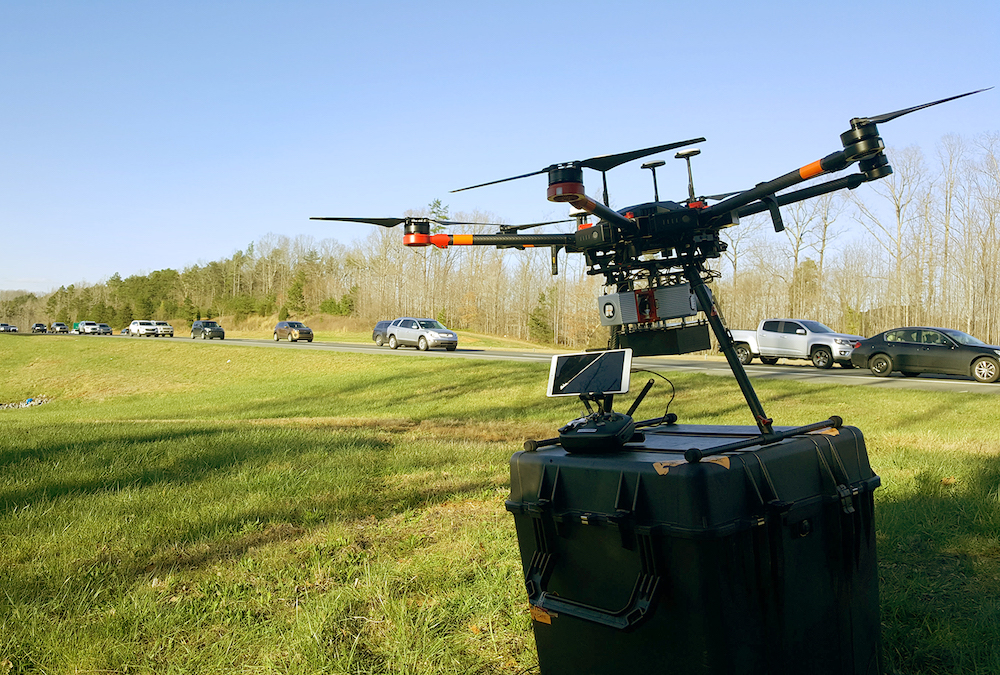
Capture visual, thermal, and LiDAR data from the air and ground. Operators can deliver photos as proof of inspection and use preliminary data to change their data collection approach as needed to better meet the project objectives.
DRONES
PROCESS 
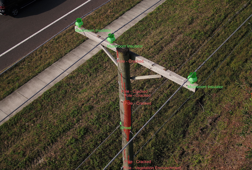
QC data for any required data recollection. Hone in on problem areas, such as corroded components on equipment. Review the overall health of assets and navigate image sets using intuitive markers, color-coded for damage severity.
FIELD PROCESSING

ANALYZE 
“Call in” criticals observed in the field and optionally, store data for additional analysis. The PrecisionAnalytics AI engine organizes and annotates imagery to address issues specific to your CVI process
PRECISIONANALYTICS
REPORT 
Generate analytics from aggregate inspection outcomes. View electrical asset health measures to identify non-compliant anomalies and trends in your data.
DELIVERABLES
API
DEVELOPMENT
.jpg?width=1000&name=cvi-5-report%20(1).jpg?54431)
ACTION 
Distribute work orders with CVI imagery for context and activate O&M vendors.
- Refine capital budgets using a comprehensive accounting of your assets, including precise geolocation
- Manage assets over a lifetime, selecting operators and materials that consistently achieve the best results
- Assess sites before bids and builds.
- Prioritize improvements based on the severity of damage using exact indicators of asset health
- Fuel network engineering strategy, modeling out-of-compliance assets in relation to other assets, roadways, and zoning
- Apply for permits and produce planometrics
- Prove regulatory compliance
- Detail work orders, with robust imagery, to repair immediate issues