04.3.2020
The agricultural industry is at an inflection point. Smart farming is growing on a global scale as agricultural professionals reconsider traditional practices in favor of new technology. Soil sensors measure field water and nitrogen content. Automated tractors deliver precision inputs. And drones capture acres of aerial imagery. These and other tools can enable farmers to gain greater yields and operational efficiencies in a time when such benefits are needed.
“Profitability has become more difficult in the agricultural industry,” said Kevin Lang, GM of Agriculture at PrecisionHawk. “Part of our mission here at PrecisionHawk is to provide tools for growers, crop consultants, insurers, and enterprise professionals in agriculture to make better, more timely decisions to ensure they aren’t leaving profits in the field.”
The key to making such decisions in implementing a simple, streamlined solution for collecting, processing, and analyzing data. One that gives agricultural professionals greater access to information about their farming assets and day-to-day operations.
To that end, drones—paired with the right analytics software—can be a powerful tool.
.jpg?width=2000&name=A532_C039_0101X6.0003553%20(1).jpg)
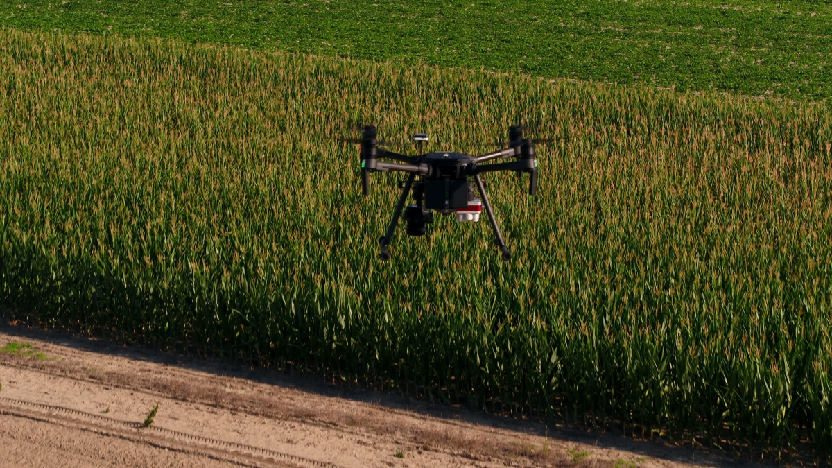
Data collection at the swipe of a button
At PrecisionHawk, our first step in helping customers who get started with drone-based aerial intelligence is to help them plan a mission. We ask them a myriad of questions - Where is the area we are flying? What types of crops are there? At which stages of development do you want to have this information collected?
From there, we can develop a specific flight plan—and in the swipe of a button, drone operators can take off with a drone and capture data.
“The flight is actually the easy part,” said Bobby Vick, Director of Agriculture at PrecisionHawk. “The challenging part is knowing what parameters to set in the software.”
Our experts, with backgrounds in agronomics and flight operations, can assist in selecting sensor hardware and in optimizing sensor settings for data collection. “We’re never going to be as good as the raw data we collect,” said Vick. “So we need to get it right when we’re in the field to ensure we get optimal analytics on the back end.”
.jpg?width=2000&name=A529_C029_0101A0.0013340%20(1).jpg)
Processing and analyzing data
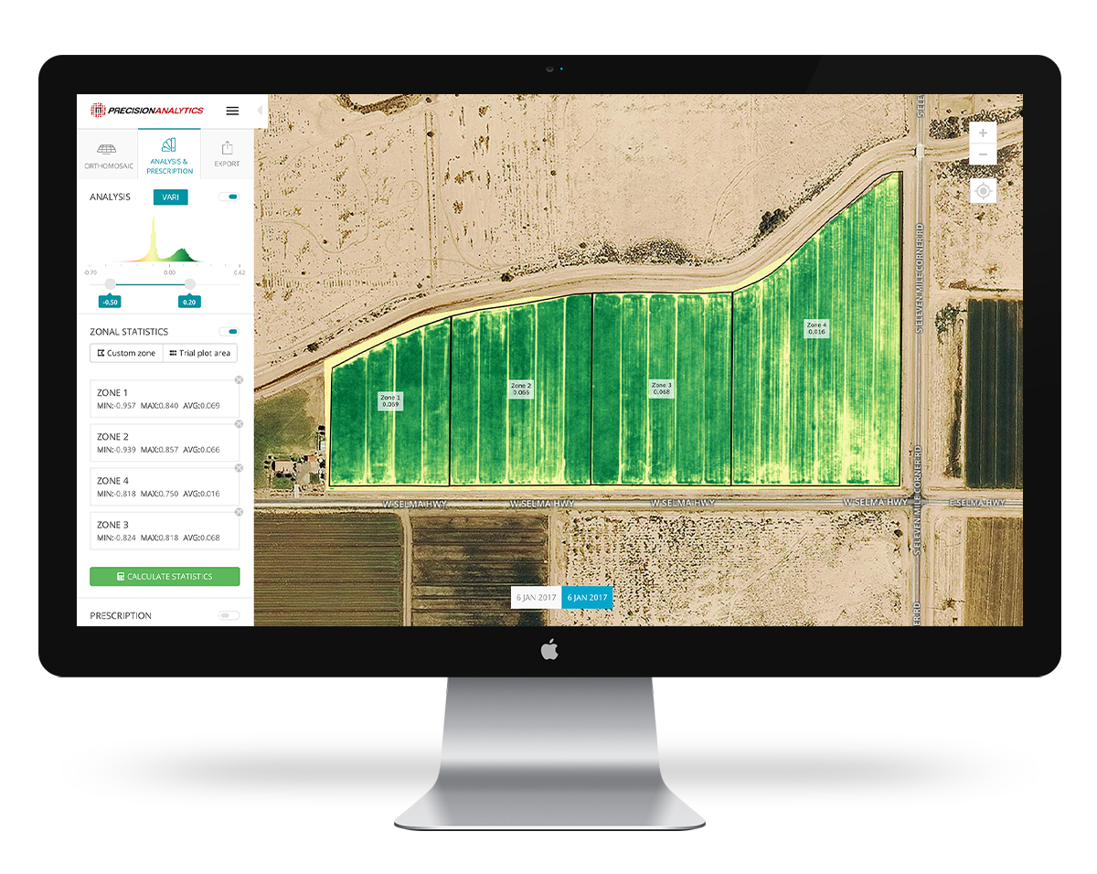
After collecting data, the next step is to process and analyze it. With our new cloud-based platform PrecisionAnalytics Agriculture, agricultural professionals are able to quickly apply a bevy of analytics to aerial data. .
“Since we’ve been in the agricultural space for many years, we have the privilege of having data that’s been collected over many different agricultural use cases,” said Vick. “Using machine learning, we’ve developed base models that are really great at object detection. The user doesn’t give any input besides the area they want to run the algorithm over.”
In PrecisionAnalytics Agriculture, a farmer can monitor crop health and yields, verify stand establishment, and run a myriad of other analytic reports within minutes.
- Crops at a glance: Review the overall health of plants to surface issues such as over-fertilization, flooding, or disease.
- Detailed views: View full-resolution imagery and zoom in on areal issues.
- Instant precision plant count: Quantify the number of plants or livestock in an area.
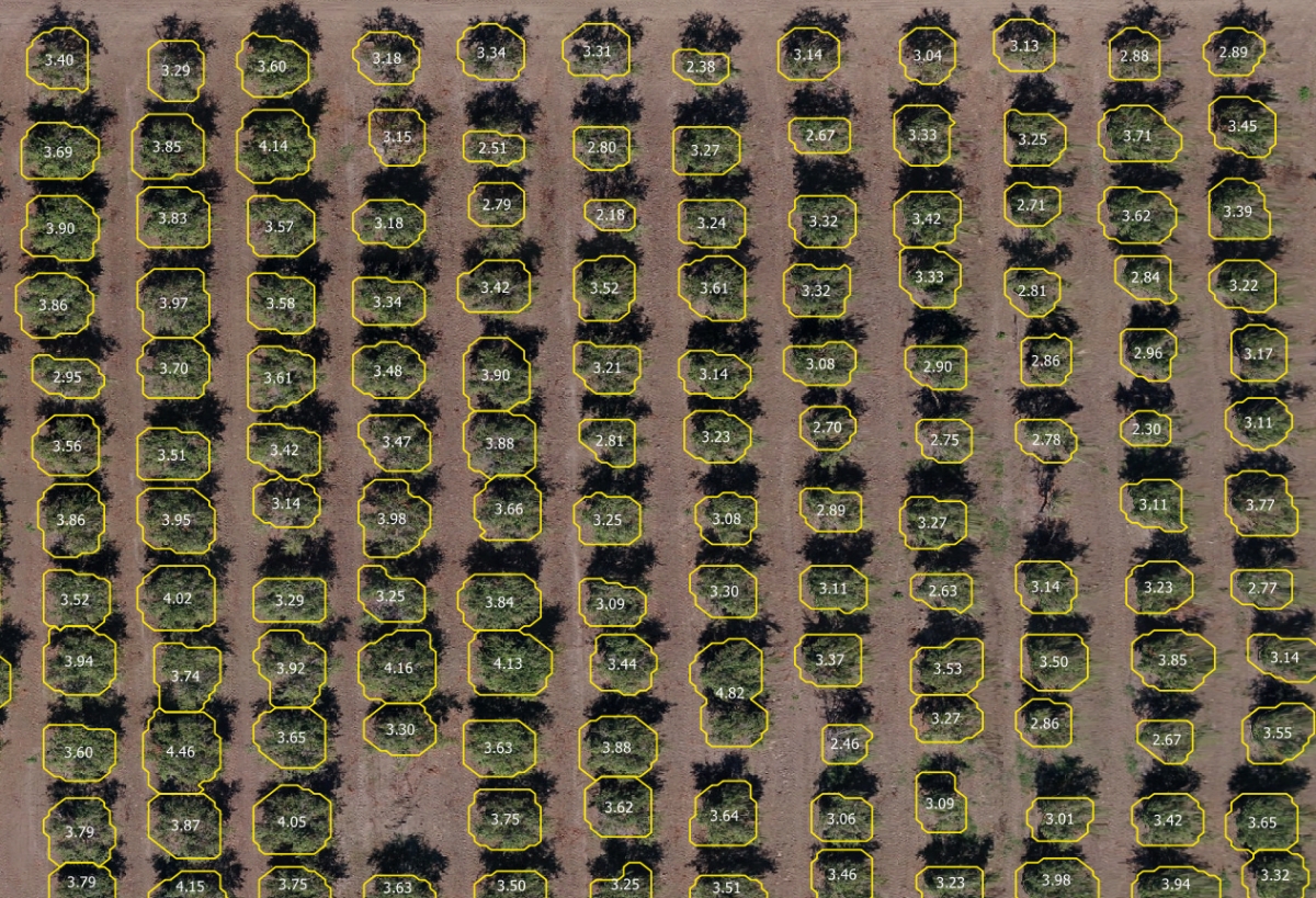
- Tree crown sizing: Delineate canopies for sizing larger plants, such as trees or vegetable crops.
- Zonal and plot statistics: Shape analysis to the unique characteristics of a field by defining custom zones or creating automatic and custom-defined plots.
- Generate prescription maps: Produce on-demand prescription maps that can be exported directly from the web interface into a farm management system.
- Comparison view: View multiple datasets at a time to analyze trends in crop growth.
- Multi-farm and -field management: Navigate all properties and associated data in a single, streamlined portal.
- Shareable web links: Easily share data with customers to foster transparency and customer satisfaction. Customers can interact with the data.
When combined, these features can deliver particularly powerful insights. For example, an agronomist evaluating a grove of oranges might combine crown sizing and vegetative indices to identify trees that might be stunted by disease or drought stress. Or a farmer might apply management zones to track perennially problematic parts of a field and the impact of alternative input management strategies. These, and other analyses, are available at the click of a button.
Making data actionable
“PrecisionAnalytics Agriculture is not only for processing data, but also for storing, managing, and making decisions upon that data,” said Vick.
PrecisionAnalytics Agriculture allows agriculture professionals to quickly export files, reports, and maps. For example, they can download an orthomosaic at whatever resolution they choose; a shape or CSV file of their zonal or plot statistics; a plant health map; an elevation map; prescription reports; or PDF reports featuring map views with their selected vegetative indices, zoomed into areas of interest.
Our web interface also enables agriculture professionals to export data into farm management systems, giving them the capability to automatically turn data into action.
Ultimately, they own their data—and they can take it anywhere they need it.
Partner with PrecisionHawk
We’re here to help you adopt smarter and more efficient farming practices. Our agricultural experts will assist in evaluating when, where, and how to incorporate drone-based aerial intelligence into your operations. Our global network of drone operators is ready to execute flights on your behalf. And our engineers are continuously optimizing PrecisionAnalytics Agriculture to better automate and accelerate your analysis.
“There's so much information that can be gleaned from the ground, but there's a whole new perspective that can be gained from our sensors in the sky,” said Vick.
Contact us today for more information on how you can use drone-based aerial intelligence in your operations.