04.3.2020
A series of unruly weather patterns staggered 2019 crop farmer profits, after 2018 farm incomes hit a 12-year low. Because farmers are typically affected by unpredictable weather and market changes, it is essential that every seed purchased turns out a healthy yield. One of the ways farmers attempt to maximize yield potential is by obtaining early season stand counts and searching for replant opportunities. But traditional stand analysis methods are time-consuming and prone to human error. With the help of drones for agriculture, farmers are gaining highly accurate stand counts and taking steps to improve yield potential.
A farmer can fly a drone over their fields in minutes to hours, gathering imagery on every single acre of crops. That data is then turned almost instantly into plant count analytics. In one software system, farmers can see their entire field or select zones, automatically quantify the number of plants per row, acre or zone, and get a highly accurate count of the number of emerged plants. In the same system, they can analyze canopy size and identify gaps in the soil to make informed replant decisions. As a result, farmers are better able to maximize the success of planting and improve yield potential for their crops.
In using PrecisionAnalytics Agriculture to perform corn stand counts, we’ve been able to achieve at least 92% accuracy when flown during the optimum growth stage.
Supplanting traditional plant count methods
When it comes to making replant decisions, time is the biggest challenge. If corn or soy is planted too late in the spring, they may not mature before the first fall frost, resulting in lost yield potential. But choosing not to replant has its own risks. Having even a couple seeds per row that did not emerge can result in thousands of plants per acre that won’t grow to produce a healthy yield.
Traditional methods of stand analysis include:
- Measuring 1/1000 of an acre, counting the number of plants within that range, then multiplying to get the average seed/acre count.
- Counting the number of plants within a 34-inch hula hoop and comparing that to a chart that indicates the number of plants/acre based on hula-hoop size
- Measuring 1/10,000 of an acre with a ruler, counting the number of emerged plants in two rows, then multiplying to get the average seed/acre emergence count.
While these methods have helped farmers for decades assess plant emergence and yield potential, they are still just estimates. More importantly, sample counts do not give the full picture of how many seeds have not emerged, and where. There could be a trend that indicates a problem with the soil or fertilizer in a certain area, causing long-term damage. Farmers might miss this by taking only a sample count. But with eyes in the sky, a drone could capture the trend and give farmers more information to work with.
Above all, a major part of stand analysis is to see whether all the seeds emerged at the same time. If a corn plant, for instance, is even one or two leaf stages behind the plants around it, it will not produce a healthy yield. The plant will struggle to compete for sunlight and nutrients, and will be choked out by the larger, healthier plants. Again, farmers might miss this by taking only a sample count.
While drones cannot predict when the first frost will arrive, they can provide more precise plant count and crop health analytics. Drone collect and turn precise information quickly enough to aide in the replant decision. Ultimately, drones provide farmers the information they need to maximize yield potential. Next, we’ll discuss how it works.
PrecisionAnalytics: an Agriculture Software Solution
PrecisionAnalytics Agriculture is a complete aerial mapping, modeling, and agronomy platform based on 10 years of agriculture analytics experience and millions of acres of crop data. The system automatically processes, organizes, and annotates geospatial data. It also applies machine intelligence/vision to automatically produce rich data visualizations, as well as machine learning to surface trends and patterns.
PrecisionAnalytics’ plant counting tool is an algorithm that enables farmers to automatically quantify and visualize crops in the context of their environment with a drone survey. It replaces traditional, error-prone and time-intensive methods of stand evaluation and plant count, such as estimating plant counts based on 1/1000 of an acre. As a result, farmers have access to more information, enabling them to make more informed decisions.
With our drone-based solution, farmers can:
- Discover: acquire a turnkey solution tailored to delivering data relevant to solving plant count and sizing problems
- Collect: fly a range of ready-to-fly drone and sensor hardware, including the cutting-edge MicaSense RedEdge or Altum sensors, to gather high-quality data
- Process & Analyze: automatically quantify the number and size of plants, and plant health analysis, streamline crop scouting and prescription map creation, and accelerate replant decisions
Collect: Increase the Quality and Quantity of Data
With PrecisionAnalytics, a farmer can fly a drone over their fields and capture imagery of their crops using high-resolution, visual and multispectral sensors. Drone surveys can shorten the time it takes to scout an entire field from days to hours. As with traditional sampling methods, it is essential to begin capturing data early, such as V1-V2 for corn, soon after emergence for other crops. That way, farmers can easily track and assess whether all plants emerged at the same time, identifying slower plants or gaps in the soil.
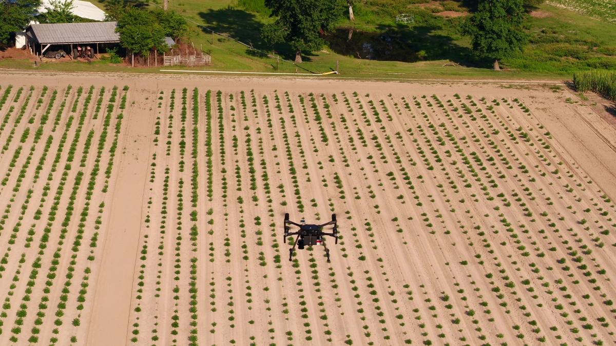
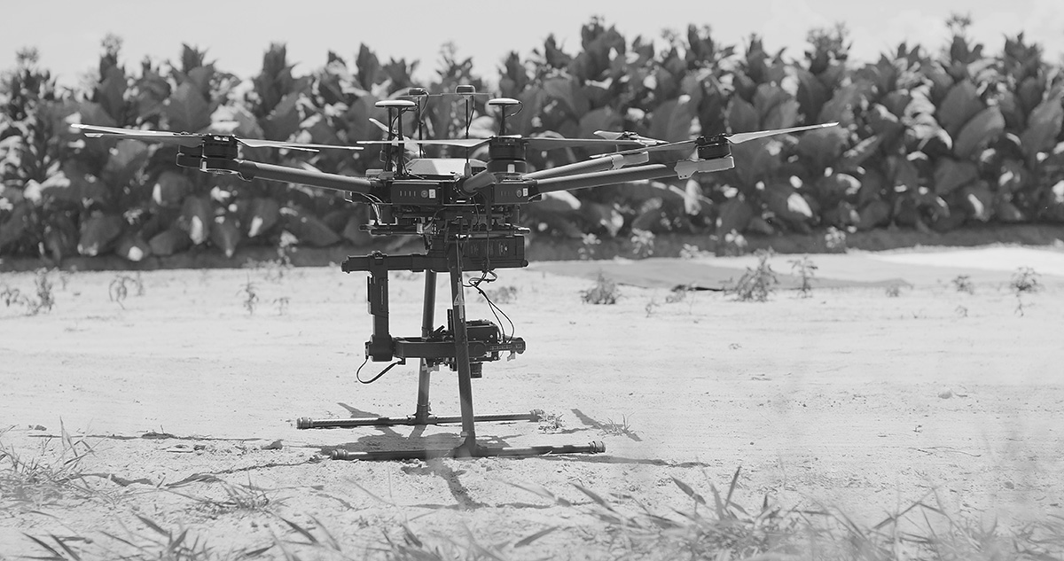
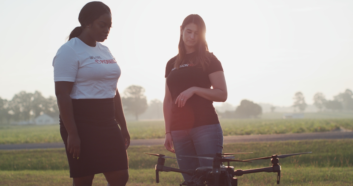
At PrecisionHawk, we offer a range of ready-to-fly flight and sensor hardware, including industry-leading MicaSense RedEdge sensors. Our agriculture experts work with farmers to assess what they’re trying to accomplish with drone-based data and analytics, and recommend a solution customized to their needs. Our drone portfolio includes a range of fixed-wing and VTOL (Vertical Take-off and Landing) drones, in addition to standard multicopter drones. These drones enable operators to fly low and slow to distinguish between leaves and shadows, ultimately providing a more accurate count.
For crop scouting and analysis, we recommend multirotor DJI Phantom 4 or DJI Mavic drones with RGB sensors, or the DJI M200 drone equipped with a MicaSense RedEdge or MicaSense Altum sensors. MicaSense’s RGB sensors are purpose-built for precision agriculture. By capturing very narrow spectral bands, between 10-40 nanometers wide, MicaSense’s sensors are able to detect subtle changes in plant color throughout the growing season.
Next, users upload that data into PrecisionAnalytics Agriculture.
Process & Analyze with PrecisionAnalytics
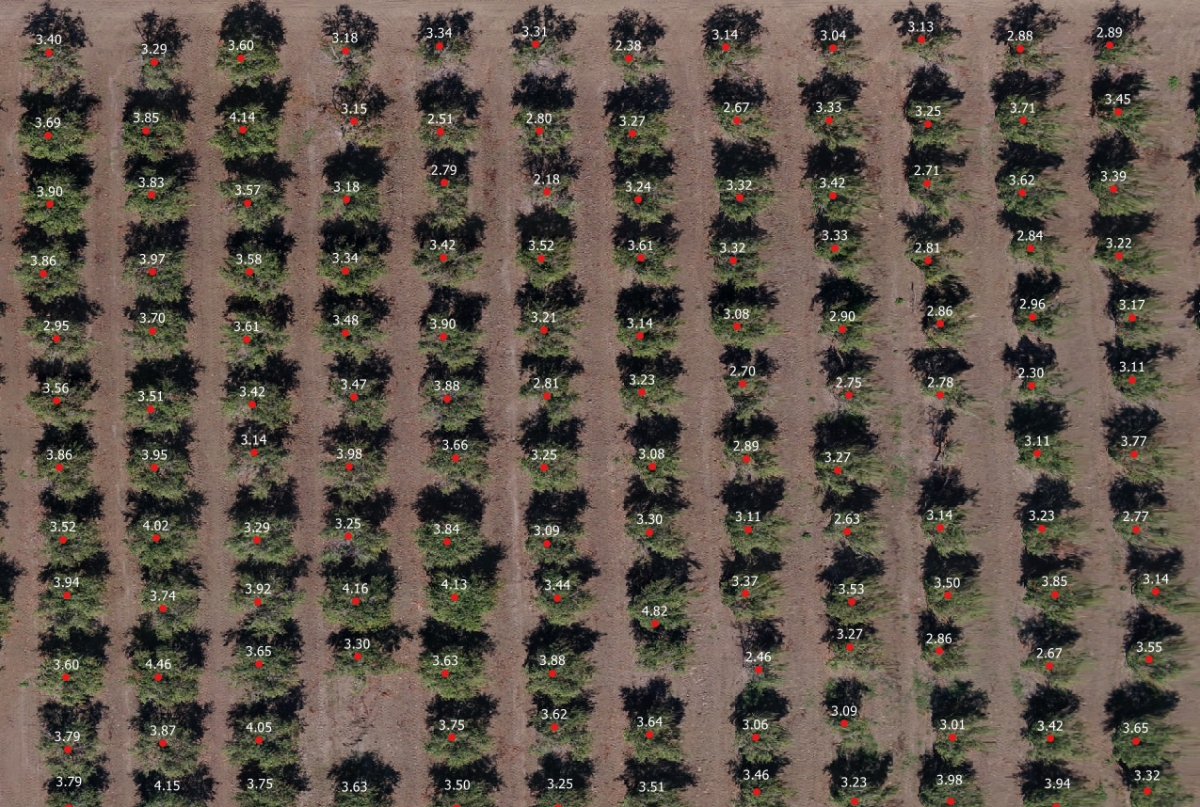
Precise Plant Count & Canopy Sizing
PrecisionAnalytics’ plant counting tool is an algorithm that enables farmers to automatically quantify their crops using a drone survey. The Plant Counting algorithm automatically detects plants--from seedlings to full canopies--and places a marker over the canopy to count it. These colorized dots indicate the size of the plant canopies relative to each other, as either small, medium, or lage. Then, farmers can see a highly accurate count of the plants in a specific row, zone, field, or custom zone.
.jpg?width=1200&name=Optimized-A531_C018_0101LV.0000848(1).jpg)
Optimizing Row Crop Yield Potential
To aide with replant decisions, the algorithm shows the gaps within each row where plants may be slower to emerge, or missing. Missing plants could indicate there was a planting equipment failure, or that the ground was too wet for the seeds to germinate. By seeing how many plants successfully emerged, and how many gaps remain, farmers can begin to understand their yield potential. As a result, they can catch more replanting opportunities to maximize the yield potential of their field.
With an aerial view, damp or dry areas of soil are easier to spot. By seeing exactly where plants are slow to emerge, farmers can begin to identify the root cause of the problem and manage irrigation inputs. Based on the time of the season and the farmer’s good judgement, they can weigh the pros and cons of replanting. But seeing the exact number of gaps in a whole field is significantly more precise than sampling a few rows. As a result, farmers may be able to replant before it’s too late and optimize their yield potential.
On the other hand, farmers can use the canopy sizing data to identify late-growing crops that may need special input management. Using the plant count tool, farmers can classify canopy sizes by diameter or area to show a comparison of the small, average, and large canopies in their field. A red dot indicates a small canopy. By viewing the number and location of smaller canopies, farmers can adjust nutritional inputs to a specific area. Ultimately, by accessing more data quicker than before, they can improve the health of their crops and optimize yield potential.
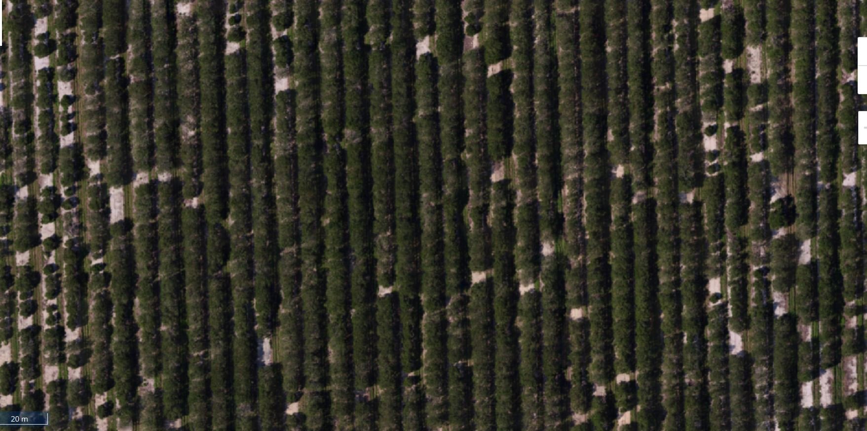
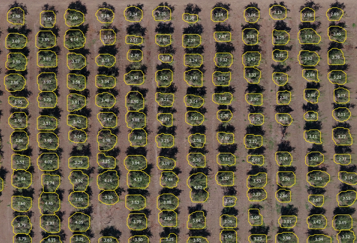
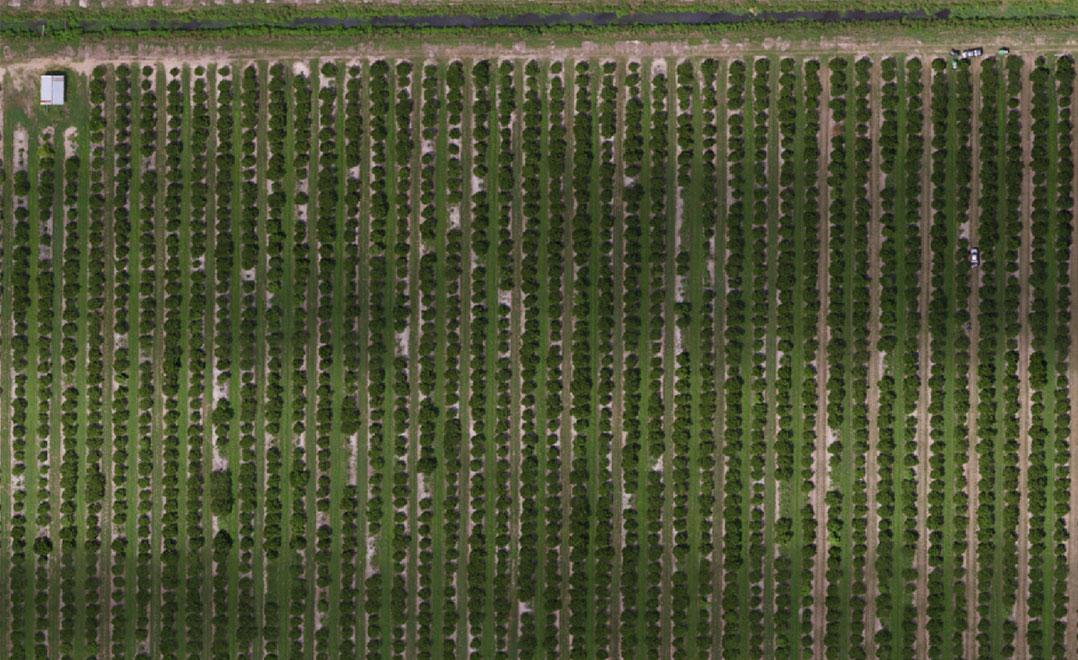
Optimizing Orchard Yield Potential
For orchard crops like citrus and nut trees, the algorithm produces a highly accurate count even when the canopies grow together in a hedge. Users of PrecisionAnalytics Agriculture can apply the plant count and sizing tool over an area of interest to analyze tree growth, segment trees by canopy size, and track plant development across the season. When trees do appear as a dense hedge, the count tool also shows the distance between each tree. Farmers can draw perimeters to isolate counts in a given area of the field, or establish zones to compare multiple parts of the field.
With an instant, automated tree count, growers can inventory their year-over-year number of trees and assess inventory accuracy. By identifying gaps among the canopies, they can see how many trees died during a season, and where, and identify potential reasons why. They can combine the plant count tool with zonal and plot statistics to compare how various rows of new trees or replants are performing during a season. If trees are underdeveloped for their age or exhibiting yellowing leaves, growers can monitor their performance and section out zones in which to manage nutrients such as pesticides, fertilizer, or irrigation. They can then track the progress of these efforts. As a result, orchardists will better be able to inventory and predict their overall yield.
Report, Integrate, Action
When they’re ready to apply plant count analytics in-field, farmers can customize, view, and share dynamic PDF reports that focus communication for a variety of stakeholders. Based on the layers of data they choose to activate in the map, users can see different components of the report. They can also zoom in on a specific area of interest and have all components of the report update to focus on just that area.
For larger farming operations managing thousands of acres, PrecisionHawk offers Data Services to streamline and accelerate reporting and decision-making.
Why PrecisionHawk?
With years of experience collecting data in the agriculture industry, using aerial mapping to count crops, our data scientists and engineers have developed some of the best-trained machine learning models in the industry. Our stand count tool is better able to detect individual crops and deliver precise analytics about count, sizing, and health based on terabytes of data across a wide variety of crops and soil types. Additionally, years of working with leading agronomists have informed our software’s design, streamlined for multi-field and farm management..
We’re here to help you adopt more efficient and effective farming practices. Our agricultural experts will assist in evaluating when, where, and how to incorporate drone-based aerial intelligence into your operations. Our global network of drone operators is ready to execute flights on your behalf. And our engineers are continuously optimizing PrecisionAnalytics Agriculture to better automate and accelerate your analysis.