04.17.2019
The following is an excerpt from our solution brief, Oil & Gas Asset Management, which explores how a drone-based platform can provide new levels of safety and efficiency in oil & gas operations. Download the solution brief to learn more.

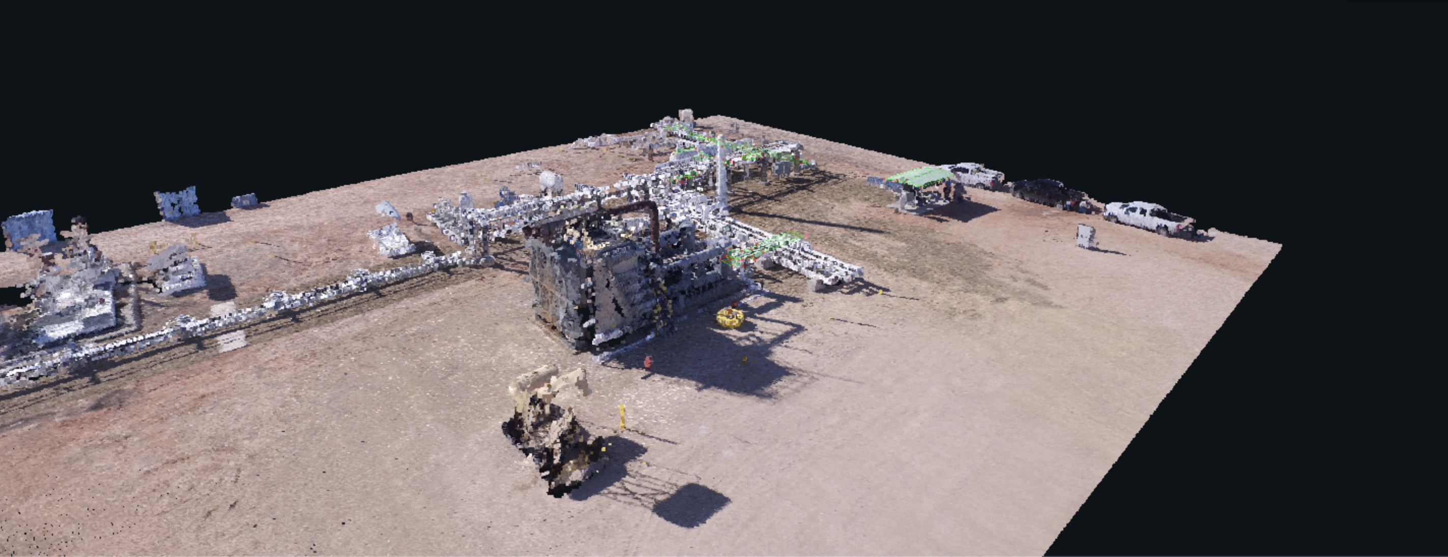
The U.S. is home to over 2.4 million miles of pipeline, making our network of energy pipelines the largest in the world. Not to mention thousands of tanks and wellpads, with superpads—those that can house 30-40 wells—becoming more and more common.
For oil & gas firms, improving asset management is paramount. It requires taking inventory of, inspecting, and maintaining hundreds of wellpads and tanks, plus miles of pipeline. The foremost methods for doing this are deploying manned aircraft to perform visual inspections, and sending roustabouts on trucks to inspect equipment manually and to inventory assets.
The problem: These methods are dangerous and expensive, and they typically don’t provide robust data.
Manned aircraft missions are inexpensive, but they’re not comprehensive—which means any information coming from the missions is not structured and is seldom actionable. Manned aircraft missions that do collect adequate data can become prohibitively expensive, making it difficult to keep tabs on all of your assets frequently enough to catch damage before it leads to failure. And beyond cost, flying helicopters is risky due to rugged terrain, weather events, and noncompliant aircraft out in the oilfield.
Besides the cost and risk, aggregating the data you collect into a single, standardized database can be messy, if not impossible.
For oil & gas firms that need to manage infrastructure over miles of terrain, PrecisionHawk provides a flexible, cost-effective, and data-intensive way to inspect assets.
By incorporating data collection, processing, and reporting into a streamlined, end-to-end drone-based solution, we’ve made it easier to start using drones. You’ll replace dangerous ground-based and manned aircraft inspections with drone deployments; unstructured data with integrated data delivered directly to your systems of record; hours of tedious image review with machine intelligence; and data overload with a focused system of reporting.
By deploying a drone-based platform, the results are clear:
- Less downtime due to unforeseen damage
- Fewer helicopter missions
- Higher accuracy in detecting issues and measuring the liquid volume in tanks, plus the percentage of water versus oil in those tanks
- Up to a 50% reduction in inspection costs and up to a 33% efficiency gain
- Faster fixes to issues
- A higher margin of safety
Selecting the Appropriate Hardware
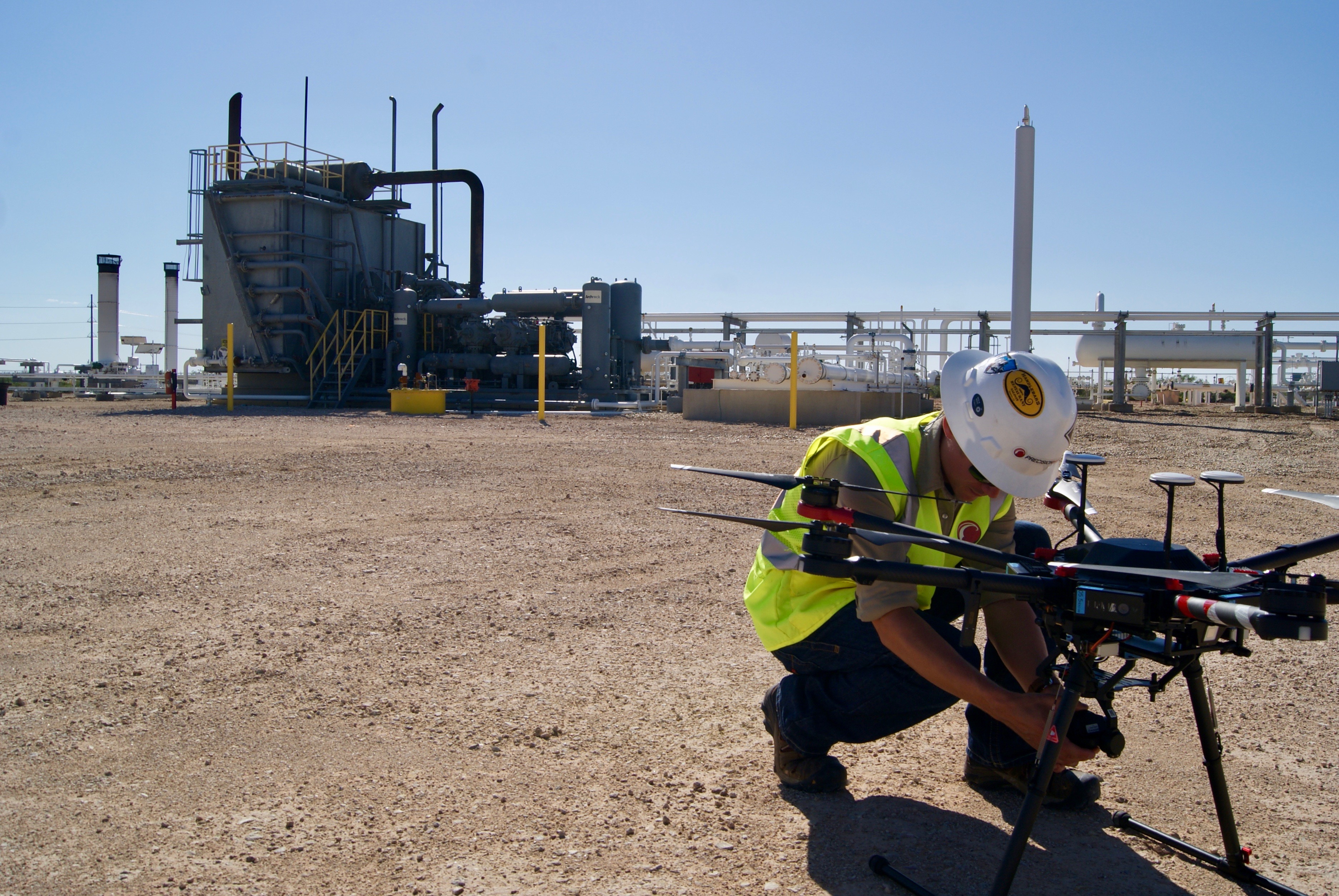
A safe and effective flight is founded on drone hardware, but oilfields and pipelines present a challenging environment for any aircraft; they may be located in windy or wet areas or on rugged terrain. Our drone operators—a.k.a pilots—fly hardware that’s purpose-built for such a challenging environment. It’s lightweight, but rugged, and includes rotor blade guards to mitigate the damage that could occur on contact.
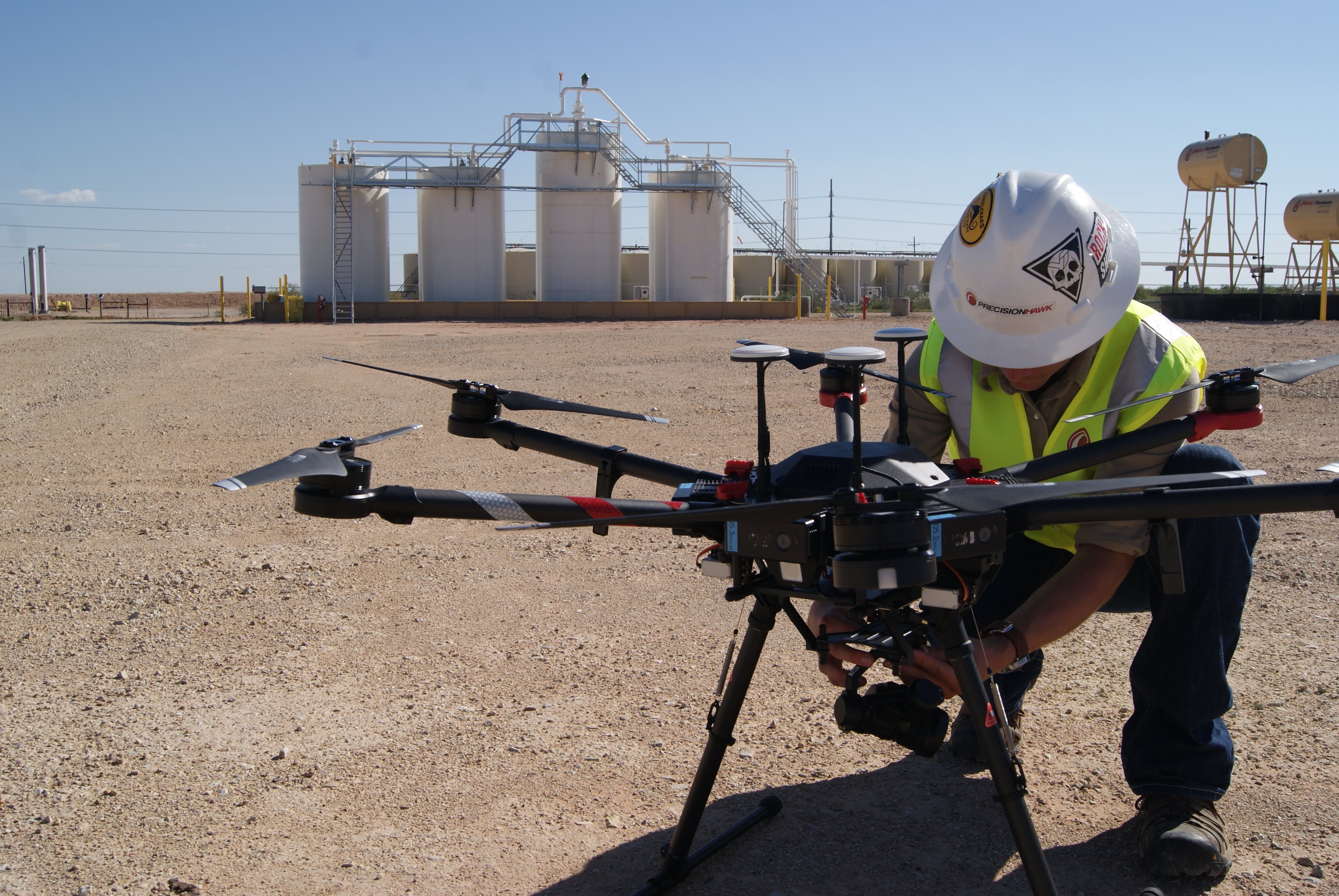
The higher the quality of the sensor payload, the higher the quality of the analysis—so our operators deploy leading thermal, infrared, and LiDAR sensors, a methane detection laser, and optical gas indicators (OGI).
For manual inspections, high zoom is ideal, so PrecisionHawk pilots might use a camera with high combined optical and digital zoom. For capturing data that will be processed by machine intelligence, they use cameras with large sensors.
If a high methane reading is detected, our operators use TDLAS lasers combined with OGI MWIR to double-check the reading.
Operating Flight Software: PrecisionFlight
To execute missions, our pilots use PrecisionFlight. The software’s intelligent flight planning enables operators to deploy manual, semi-autonomous, and fully autonomous missions that comply with regulations and safety management systems.
A Typical Mission:
- Prior to a mission, the drone operator defines a flight plan by combining oil & gas equipment specifications with 3D geospatial data, such as the surrounding terrain and no-fly zones.
- To identify potential issues, they emulate the flight in PrecisionFlight, setting additional boundaries as necessary.
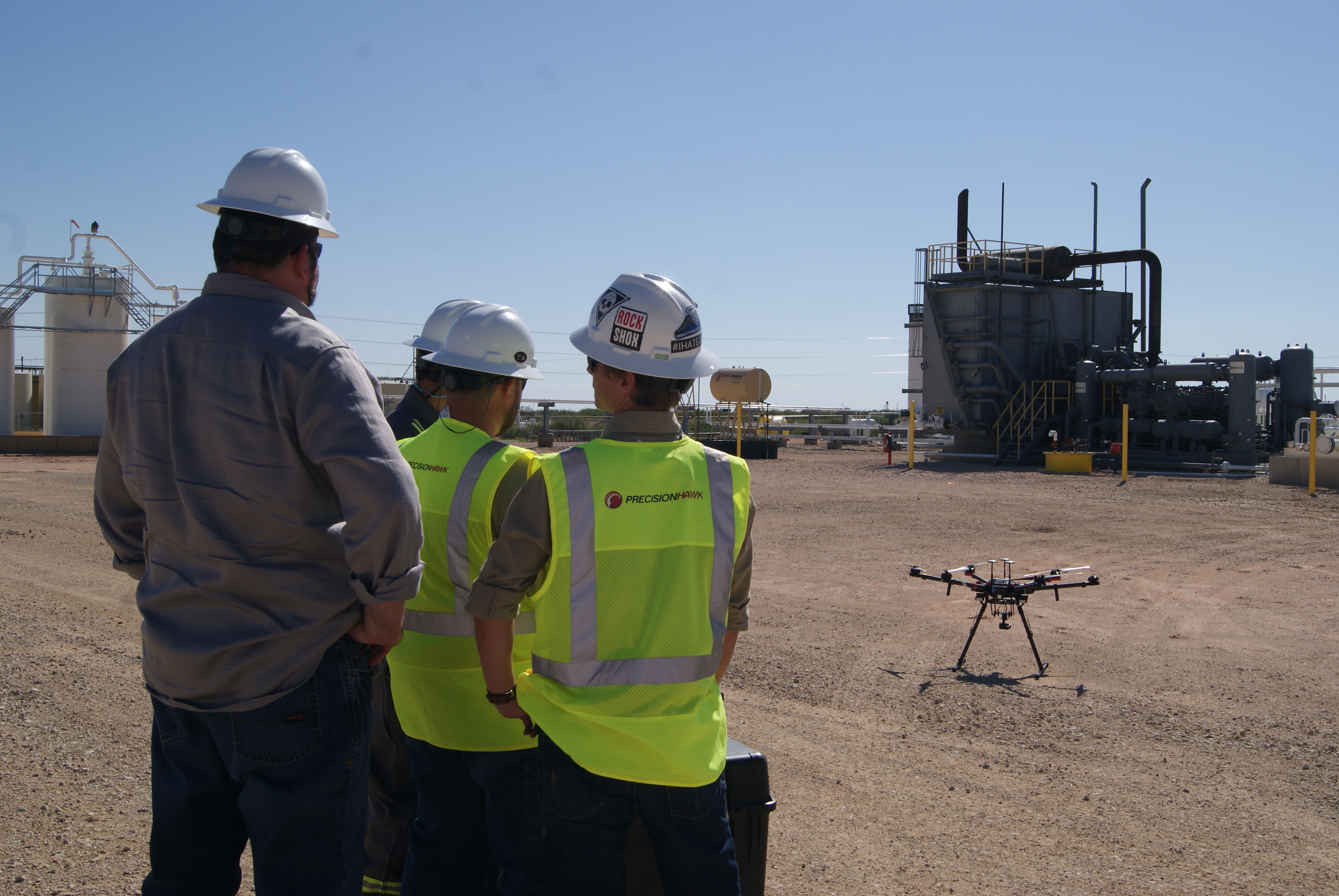
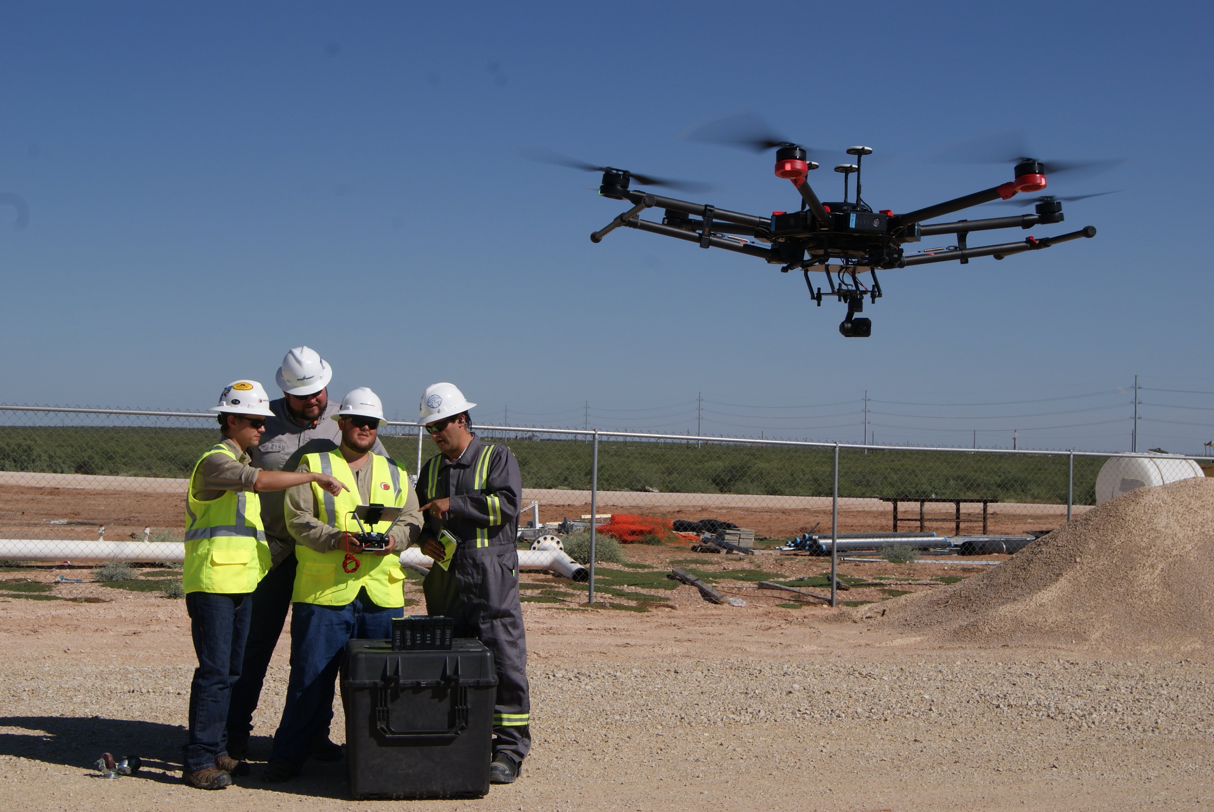
- Once on-site, operators load the plan (no connectivity required), deploy the drone, and monitor it—using flight telemetry—as it automatically captures data along a precise flight path, predetermined by a set of waypoints.
- The drone captures imagery from all angles. If issues requiring further inspection surface during autonomous flight, the operator can manually navigate to the area of concern.
- After the mission, the pilot can “replay” the mission to assess mission efficacy and optimize the flight plan.
While capturing asset conditions at a single point in time is useful, you can gain greater insight by tracking trends over a given period. Using PrecisionFlight’s repeatable flight plans, operators are able to capture multiple data sets, from separate missions, that correlate precisely.
PrecisionFlight’s advanced features make drone-based inspections accessible. With the right training, anybody can conduct safe, fast, and effective missions.
Conducting Safe and Effective Flight Operations
Beyond flight software, the skills of your drone operators are critical to the safety and effectiveness of your drone-based inspections. The pilot in command must understand your objectives and follow rigorous procedures, regardless of whether they’re your own staff or PrecisionHawk’s experienced flight operators.
To meet these requirements, PrecisionHawk’s leaders—many of whom are former Navy Top Gun pilots—developed our industry-leading drone operating procedures:
- Mission Requirements: Understand the assets and area of interest to be inspected, and the specific requirements of the mission.
- Mission Readiness: Complete a rigorous training program for the complete mission lifecycle, from analyzing airspace around wellpads, tanks, facilities, and pipelines to managing unusual asset configurations and weather patterns.
- Procedure: Follow flight standards, a comprehensive mission checklist, safety management systems, and incident protocols.
- Regulatory Compliance: Comply with guidelines, designed by our policy analysts, to limit regulatory exposure.
- Quality Assurance: Verify that the data meets quality requirements using PrecisionHawk’s offline field analysis tool; identify anomalies, omissions, and other issues prior to delivery.
- Data Secure Chain of Custody: Protect mission data by following secure transportation, transmission, and destruction protocols.
- Continuous Improvement: Engage in a continuous improvement plan, reporting lessons learned and applying them to future operations.
These are principles we require of all of PrecisionHawk’s flight stakeholders. Whether they’re our 100-plus full-time pilots, the more than 15,000 pilots in our drone pilot network, or our clients’ own staff, we’ve designed our training regimen to help professionals of any background achieve this standard of excellence. And everyone, from program directors to visual observers, is responsible for maintaining discipline in the field.
A Streamlined System of Integrating Data
After you collect data, you need a focused system for analyzing and processing it. Sure, your analysts can pore over the terabytes of raw imagery and video that result from drone-based inspections. But, by harnessing the power of machine learning, you can hone the process, improving the overall precision and time-to-value of your module health analysis.
With our aerial intelligence platform, drone operators can upload data and imagery into PrecisionHawk’s cloud-based system, PrecisionAnalytics, which cross-references the uploaded imagery against thousands of terabytes of oil & gas asset equipment, flagging issues.
PrecisionAnalytics features include:
- Infrastructure Statistics: Get a comprehensive view of all your assets, including wellpads, tanks, facilities, and pipeline—separately or all at once. Segment your health trends at the portfolio or site level: view rolled-up statistics on damage severity, issues, and other measures you identify.
- Vegetation Map: View an encroachment map overlaid on a street map, or in a 3D point cloud model, to ensure the areas around assets are clear.
- Equipment at-a-Glance: Hone in on problem areas, such as water pooling on a wellpad. Review the overall health of assets and navigate image sets using intuitive markers, color-coded for damage severity.
- Detailed Views: View full-resolution imagery and zoom in on key issues.
- In-situ Communication: Create and edit annotations and store metadata, such as the type of observation, your finding, the size of the issue, damage severity, and other parameters. Add comments to other stakeholders.
- Historical Recordkeeping: Investigate the genesis of an issue. View historical imagery for the same location on the equipment from prior inspections to identify potential precursors to the issue at hand.
Typical issues that analysts identify using drone-based imagery include:
- Hotspots on equipment
- Open thief hatches
- Pipeline and tie-in methane emissions
- Pooling of water on wellpads or around facilities
- Encroaching vegetation
- Produced water spills
Our team of data analysts can produce these annotations or we can leave it up to you.
Actioning Data
Once analysts have produced their findings, others need to take action. But how do you give cross-functional and external stakeholders the insights they need (without exposing them to the voluminous detail)?
PrecisionAnalytics’ flexible reporting and integration features enable you to distribute information across your organization—whether it be exporting an Excel and Word document or integrating with other software, such as Enterprise Resource Planning (ERP) and asset management systems. This allows for faster fixes to issues.
By developing a workflow and communication protocol that maximizes the potential of your aerial intelligence, each of these tools will let you turn data into action. And in doing so, your stakeholders will benefit from the power of drones.
Put Drone-Based Aerial Intelligence to Work
Our industry experts can assist in your evaluation of when, where, and how to incorporate drone-based aerial intelligence into your operations. Our global network of drone operators and trainers are ready to execute safe, efficient, and effective flights on your behalf. And our engineers are daily optimizing PrecisionAnalytics to better automate and accelerate your imagery analysis and reporting. Through all, we’re with you every step of the way.
Download our full solution brief for more details on how you can use drone-based aerial intelligence across the oil & gas asset lifecycle.
To speak with one of our consultants about our Oil & Gas Solution, contact us.