08.16.2021
The following is an excerpt from our Expert Insights: The Top Utility Trends of 2020 & 2021 ebook. You can access the full report here.

2020 was the year of data overload—but it’s got nothing on what 2021 will bring.
THE CHALLENGE
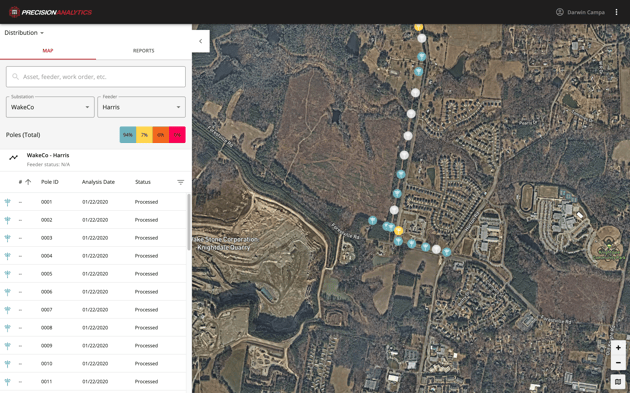
Satellite data is steadily increasing as we find more use cases for it, and new technology tools make it easier to collect and use this data. In fact, market research analysts at Technavio predicted in 2017 that the global commercial satellite imaging market would grow by over 11% through 2021.
The challenge? It’s the same one we discussed in 2020 trends, only amplified: so much data that it’s difficult to separate the usable from the useless and the important from the trivial.
THE OPPORTUNITY
AI and ML technologies will continue to advance, enabling utilities to keep up with the explosion of data so they can organize and analyze as much data as they can collect from satellites and other sources.
Download our ebook, Expert Insights: The Top Utility Trends of 2020 & 2021, to learn how you can take advantage of 2020 trends and 2021 predictions in data collection and GIS technology.