In our Drone Service Provider Business Guide, you’ll learn how to earn an income flying drones. Read it now.
In this post, we’ll review the software you need to purchase when starting a drone business.
Selecting the proper hardware is only the first step in becoming a drone service provider—you’ll also need to purchase the right mapping and flight planning software to automate flights, review surveys offline, and process your data into meaningful business intelligence. While you have a variety of software providers to choose from, it is important to select an easy-to-use, comprehensive platform to ensure the success of your commercial projects.
Here are the types of software applications you need and features to look for:
Flight Planning Software
In its simplest form, commercial drone flight planning comes in the form of a mobile application that enables drone operators to capture aerial imagery, semi-autonomously. Look for features that enable you to:
- Accommodate a variety of sensors and environmental conditions
- Fly the most efficient path
- Conduct recurring surveys using a single flight plan
- Operate without an Internet connection
- Pass imagery to viewing and mapping applications, seamlessly
- Bring-your-own-device
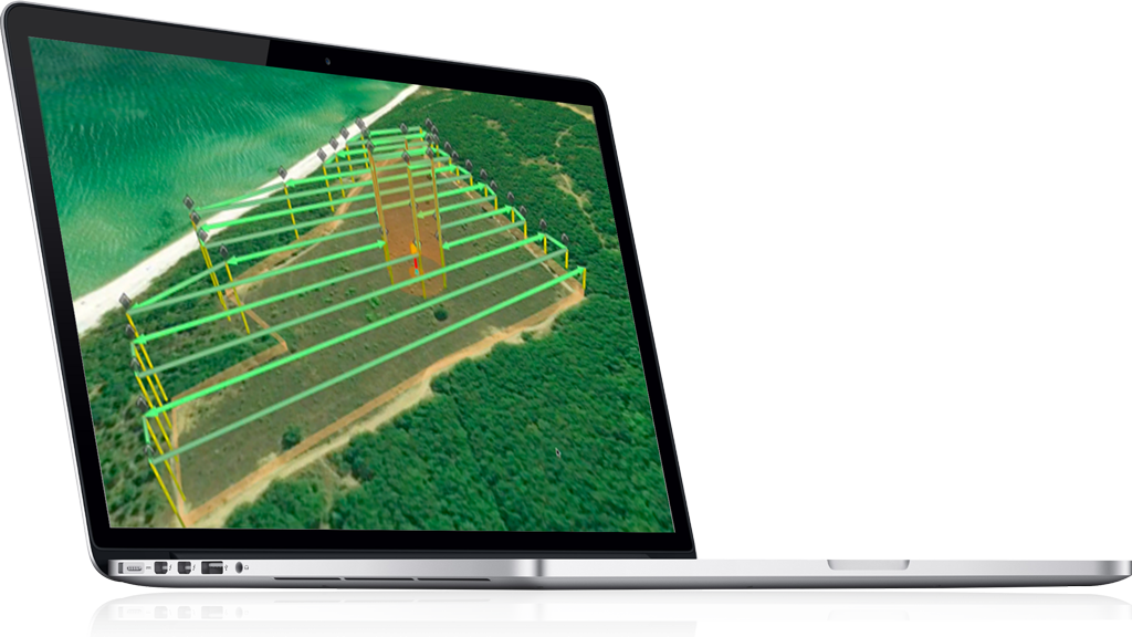
For more advanced missions, you’ll need an application that offers more sophisticated flight controls. This includes the ability to:
- Set custom waypoints
- Create routes from KML
- Follow terrain; import digital elevation models (DEM)
- Plan missions in 3D space
- View telemetry
- Emulate flights
- Import or define constraints, such as no-fly zones and route limits
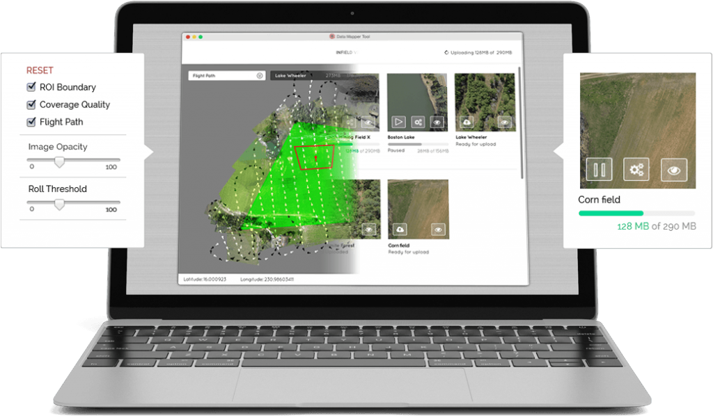
Software for Viewing Pre-processed Aerial Imagery
To ensure the quality of your data outputs while our in the field, you’ll need an application that allows you to view and assess aerial imagery and make flight path adjustments. Look for one that allows you to:
- View site surveys as they happen or minutes after landing
- Evaluate image quality
- Add ground control points to ensure data accuracy
- Compress data for uploading to the cloud
- Operate without an Internet connection
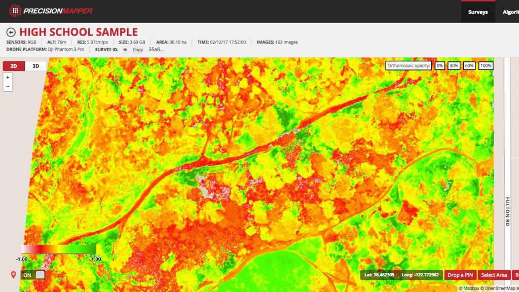
Mapping and Analytics Software
To generate reports based on your aerial imagery, you’ll need an application that automatically processes data into 2D maps, 3D models, and analyses. Look for a platform that can:
- Upload data directly from your flight planning software
- Process imagery from a range of sensors
- Serve a variety of data outcomes using a library of algorithms
- Enable you to collaborate with team members and clients
PrecisionHawk offers both free and advanced drone software and data analytics, like those mentioned above. Learn more about our software here: https://www.precisionhawk.com/software
Get the Guide to Starting a Drone Business
To learn everything you need to know about starting your own drone business, read our Drone Service Provider Business Guide. Or speak with one of our experts today.