The Surveying package, which includes DJI’s Phantom 4 Pro coupled with PrecisionHawk’s flight and analytics software, PrecisionMapper, is geared towards businesses and individuals who want to implement drone technology to improve production efficiency across different industries beyond agriculture such as: Construction, Mining, Insurance and Energy.
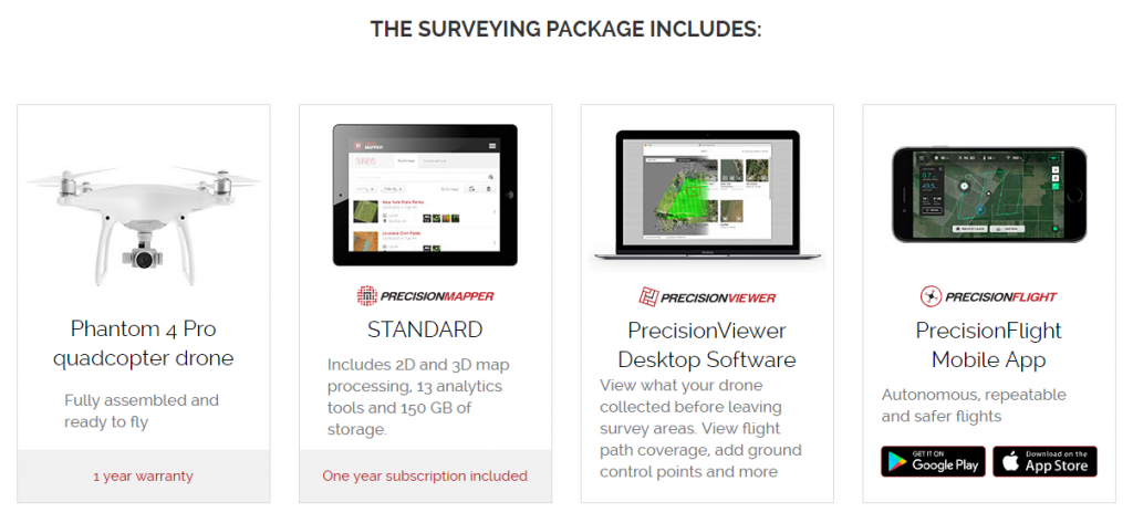
PrecisionHawk is making it easier for professionals to adopt drone technology and prove the return on investment by launching an easy to use and low cost kit. The Surveying Package combines DJI’s Phantom 4 Pro and a one-year subscription to PrecisionMapper analysis software, which includes 2D and 3D map processing, access to Volumetrics, RGB vegetation indices, and other analysis tools, as well as its flight software app, PrecisionFlight, that programs the drone to fly the desired area of interest automatically.
The goal of the package is to provide a way to perform rapid aerial processing and analysis for same day information delivery. With collection made so simple, users focus their energy on using and analysing data, rather than working out how to gather it.
The ability to make efficient use of a budget is at the forefront of most people´s minds. Drone mapping can fit seamlessly into pre-existing budget allocations and can also increase company budget and time to spend on other tasks. The increased speed and automation that drone mapping provides permit companies to safely take on and complete more jobs for more clients, on more sites, in less time.
Drones provide valuable data to companies and individuals who are considering major projects on large areas of land in a wide variety of industries such as:
Agriculture: soil and field analysis, crop scouting & monitoring, health assessment and insurance.
Construction: pre-construction surveying, volumetric measurement, progress monitoring, inventory management, health & safety and risk mitigation.
Energy: Oil & gas, solar farms, pipelines, infrastructure, utilities and more.
Insurance: Claims & underwriting, risk mitigation, property inspections, post-catastrophe assessment.
Mining: Monitoring, planning, reports, stockpile measurement, safety & compliance, oversight & reclamation.
By offering the Surveying Package, PrecisionHawk aims to make seamless aerial information tools more accessible and appealing to first time users. For more information, contact us at info@precisionhawk.com.